Where Are Most Of The California Fires
California, known for its diverse landscapes and climate, has been plagued by devastating fires in recent years. These fires are not random events but are influenced by a combination of geographical, climatic, and human factors. Geographically, certain regions of California are more prone to fires due to their terrain and vegetation. Climate and weather conditions, such as droughts and strong winds, significantly contribute to the spread and intensity of these fires. Additionally, human activities including urban development, land use patterns, power line infrastructure, and agricultural practices play a crucial role in determining where and how frequently fires occur. Understanding these factors is essential for mitigating the impact of California fires. This article will delve into the geographical hotspots where fires are most common, explore how climate and weather factors exacerbate these fires, and examine the impact of human activities on fire locations. By analyzing these elements, we can better comprehend the complex dynamics behind California's fire crisis and move towards more effective prevention and management strategies. Let's begin by identifying the geographical hotspots of California fires.
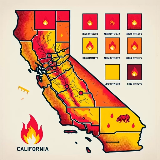
Geographical Hotspots of California Fires
California, known for its diverse and often fragile ecosystems, is prone to devastating fires that can ravage various geographical hotspots. Understanding these hotspots is crucial for mitigating the impact of these fires. This article delves into three critical regions: Coastal Regions and Mountainous Areas, Central Valley and Agricultural Lands, and Urban-Wildland Interface Zones. Each of these areas presents unique challenges and vulnerabilities to fire risks. In Coastal Regions and Mountainous Areas, the combination of dry vegetation, strong winds, and steep terrain creates a perfect storm for rapid fire spread. Here, fires can quickly escalate from small blazes to massive infernos, threatening both natural habitats and residential communities. The Central Valley and Agricultural Lands are another hotspot, where agricultural activities and dry conditions during summer months increase the risk of fires. These fires not only damage crops but also pose significant threats to rural communities and wildlife. Lastly, Urban-Wildland Interface Zones are particularly vulnerable due to the proximity of urban development to wildland areas. This interface can lead to catastrophic consequences as fires can easily transition from wildlands to residential areas, highlighting the need for stringent fire prevention and management strategies. By examining these distinct geographical hotspots, we can better understand the complexities of California's fire landscape and develop more effective strategies for prevention and mitigation. Let's begin by exploring the specific challenges and risks associated with Coastal Regions and Mountainous Areas.
Coastal Regions and Mountainous Areas
Coastal regions and mountainous areas in California are two distinct geographical hotspots that are prone to fires, each with its own unique characteristics and fire dynamics. Along the coastal regions, fires are often driven by strong winds, particularly the Santa Ana winds in Southern California and the Diablo winds in Northern California. These winds can spread embers quickly, igniting dry vegetation and fueling rapid fire spread. The coastal areas also experience a Mediterranean climate with dry summers and mild, wet winters, creating a fire-prone environment due to the accumulation of dry underbrush and dead vegetation. In contrast, mountainous areas such as the Sierra Nevada and the Coast Ranges are characterized by dense forests, steep terrain, and varied elevations. Here, fires can be fueled by dense stands of trees, dead wood, and other combustible materials. The terrain in these areas can make firefighting challenging due to limited access and the potential for fires to spread rapidly uphill. Additionally, mountainous regions often experience lightning strikes during thunderstorms, which can ignite fires in remote and hard-to-reach areas. Both coastal and mountainous regions are susceptible to human activities that can spark fires, such as arson, accidental ignition from cigarettes or campfires, and electrical malfunctions. Climate change has also played a significant role in exacerbating fire risks by increasing temperatures, reducing rainfall, and extending the fire season. Understanding these geographical hotspots is crucial for fire prevention and mitigation strategies. For instance, prescribed burns and forest management practices are often employed in mountainous areas to reduce fuel loads and prevent catastrophic fires. In coastal regions, fire breaks and defensible spaces around homes are critical to protect against wind-driven fires. In summary, the combination of climatic conditions, vegetation types, and human activities makes both coastal regions and mountainous areas in California highly vulnerable to fires. Recognizing these factors is essential for developing effective strategies to prevent, prepare for, and respond to wildfires in these geographical hotspots.
Central Valley and Agricultural Lands
The Central Valley of California, a vast and fertile region, plays a crucial role in the state's agricultural landscape but is also a geographical hotspot for wildfires, albeit less frequently than other areas. Stretching over 450 miles from the Cascade Range in the north to the Tehachapi Mountains in the south, the Central Valley is divided into two main sections: the Sacramento Valley to the north and the San Joaquin Valley to the south. This region is renowned for its rich soil, mild climate, and extensive irrigation system, making it one of the world's most productive agricultural areas. Here, farmers cultivate a wide range of crops including almonds, avocados, grapes, tomatoes, and dairy products. Despite its agricultural significance, the Central Valley is not as prone to wildfires as other parts of California like the Sierra Nevada foothills or coastal regions. However, it is not entirely immune to fire risks. The area's dry summers and occasional strong winds can create conditions conducive to wildfires, especially in areas where agricultural lands meet wildland-urban interfaces. For instance, the 2018 Mendocino Complex Fire, while primarily affecting Mendocino and Lake counties, highlighted how quickly fires can spread across diverse landscapes. Agricultural practices in the Central Valley also have implications for fire management. Crop residues and dry vegetation can act as fuel for fires, and the region's extensive network of irrigation canals and ditches can sometimes hinder firefighting efforts by limiting access. However, farmers and agricultural communities are increasingly adopting fire-safe practices such as creating defensible spaces around farm buildings and using prescribed burns to manage crop residues. In addition to these measures, technological advancements are being integrated into agricultural operations to enhance fire prevention and response. Drones equipped with thermal imaging cameras are used to monitor fields for early signs of fires, while advanced weather forecasting helps predict high-risk fire days. These innovations not only protect agricultural lands but also contribute to broader wildfire mitigation strategies across California. While the Central Valley is less frequently associated with major wildfires compared to other geographical hotspots in California like Napa County or Los Angeles County, it remains an important area for fire prevention and management efforts. The interplay between agricultural activities and wildfire risk underscores the need for coordinated strategies that balance economic productivity with environmental safety. By understanding these dynamics, stakeholders can better prepare for and respond to wildfires in this critical agricultural region.
Urban-Wildland Interface Zones
Urban-Wildland Interface (UWI) zones are critical geographical areas where human settlements and wildland vegetation intersect, posing significant risks and challenges, particularly in the context of California fires. These zones are characterized by the proximity of residential areas to wildland fuels such as forests, grasslands, and brushlands. The interface between urban development and wildland ecosystems creates a unique set of fire hazards due to the combination of flammable vegetation, topography, and human activities. In California, UWI zones are prevalent due to the state's rapid urbanization and the natural expansion of cities into surrounding wildlands. Areas like the Sierra Nevada foothills, the San Bernardino Mountains, and coastal regions around Santa Barbara and San Diego are prime examples of UWI zones. Here, the intermix of residential homes with wildland fuels increases the risk of wildfires spreading quickly from natural areas into populated communities. The geography of these zones exacerbates fire risks. Steep slopes, canyons, and valleys can funnel winds, accelerating fire spread. Additionally, the Mediterranean climate of California, marked by hot, dry summers and mild, wet winters, creates conditions ripe for wildfires. Human activities such as arson, accidental ignition from cigarettes or machinery, and electrical malfunctions further elevate the risk. Fire management in UWI zones is complex and requires a multi-faceted approach. This includes creating defensible spaces around homes by clearing flammable vegetation, using fire-resistant materials in construction, and implementing strict fire safety regulations. Prescribed burns and other forms of fuel management are also crucial in reducing the accumulation of combustible materials. Despite these measures, California has seen numerous devastating fires in recent years that have highlighted the vulnerabilities of UWI zones. The 2018 Camp Fire in Paradise and the 2020 Zogg Fire in Shasta County are stark reminders of the dangers posed by these interfaces. These incidents underscore the need for enhanced preparedness, better land-use planning, and more effective emergency response strategies to mitigate the impacts of wildfires in these sensitive areas. In conclusion, Urban-Wildland Interface zones in California represent a critical hotspot for fire risk due to their unique combination of geographical, climatic, and human factors. Understanding these dynamics is essential for developing effective strategies to prevent, prepare for, and respond to wildfires in these high-risk areas. By addressing the challenges posed by UWI zones, California can better protect its communities and natural resources from the ever-present threat of wildfires.
Climate and Weather Factors Contributing to Fires
Climate and weather factors play a crucial role in the ignition and spread of fires, highlighting the complex interplay between various environmental conditions. Drought conditions and water scarcity, for instance, create an arid landscape where vegetation is highly flammable, setting the stage for devastating wildfires. High winds and Santa Ana conditions further exacerbate the situation by spreading embers rapidly and fueling the intensity of fires. Additionally, temperature fluctuations and heatwaves contribute to the drying of vegetation, making it more susceptible to ignition. Understanding these factors is essential for predicting and mitigating fire risks. Drought conditions, in particular, are a significant precursor to many wildfires. When regions experience prolonged periods of low rainfall, the ground and vegetation become increasingly dry, creating a tinderbox ready to ignite at the slightest spark. This sets the stage for a potentially catastrophic fire season, emphasizing the need for vigilant monitoring and proactive measures to manage water resources and prevent fires. Transitioning to the specific impact of drought conditions, it is clear that water scarcity is a critical component in the fire equation. The next section will delve into the details of how drought conditions and water scarcity contribute to the heightened risk of wildfires.
Drought Conditions and Water Scarcity
Drought conditions and water scarcity play a critical role in exacerbating the risk and severity of wildfires, particularly in regions like California. Prolonged droughts lead to the desiccation of vegetation, turning what would otherwise be green and resilient into highly flammable fuel. This dry vegetation, combined with the state's Mediterranean climate characterized by hot, dry summers, creates an environment ripe for ignition. When drought persists, the soil moisture levels drop significantly, affecting both the health and density of plant life. Dead and dying plants become tinder, ready to ignite at the slightest spark. The water scarcity that accompanies drought further complicates fire prevention and suppression efforts. Firefighters rely on adequate water supplies to combat fires effectively, but during droughts, these resources are often limited. This scarcity can hinder the ability to respond quickly and efficiently to emerging fires, allowing them to spread more rapidly. Additionally, drought-stricken areas often experience increased wind speeds due to the lack of moisture in the air, which can fan flames and spread embers over wider areas. Climate change has also been linked to increased frequency and severity of droughts in California. Rising temperatures and altered precipitation patterns contribute to longer dry seasons, exacerbating the conditions that lead to wildfires. The state's fire season, once confined to the summer months, now extends well into the fall and even winter due to these changing climate conditions. Moreover, water scarcity impacts agricultural practices and land management strategies. Farmers may resort to more intensive irrigation methods or alter crop choices, which can have unintended consequences on local ecosystems and fire risk. For instance, certain crops may require more water than others, straining local water resources and leaving less for fire prevention. In summary, drought conditions and water scarcity are pivotal factors in the complex interplay of climate and weather elements that contribute to the prevalence and intensity of wildfires in California. Understanding these dynamics is crucial for developing effective strategies in fire prevention, land management, and emergency response to mitigate the impact of these devastating events. By addressing these underlying issues, California can better prepare for and respond to the increasing threat of wildfires in a changing climate.
High Winds and Santa Ana Conditions
High winds and Santa Ana conditions are critical climate and weather factors that significantly contribute to the spread and intensity of fires, particularly in California. The Santa Ana winds, named after the Santa Ana Canyon in Southern California, are strong, dry winds that originate from the Great Basin and blow towards the coastal regions. These winds are characterized by their high velocity, often exceeding 60 miles per hour, and their extremely low humidity levels, sometimes dropping below 10%. This combination of strong gusts and arid air creates a highly combustible environment. During Santa Ana events, the dry air desiccates vegetation, turning it into tinder that can ignite easily. Once a fire starts, the powerful winds can spread embers over long distances, rapidly expanding the fire's footprint. The direction and speed of these winds also make firefighting efforts challenging, as they can change suddenly and unpredictably, pushing fires in multiple directions. In California, where vegetation is often dense and dry due to the Mediterranean climate, Santa Ana conditions are particularly hazardous. The state's topography, with mountains and valleys, can funnel these winds into narrow channels, increasing their speed and intensity. This is especially true in areas like Los Angeles and San Diego counties, where the intersection of mountain ranges and coastal areas creates a perfect storm for fire propagation. The timing of Santa Ana winds is also a factor; they typically occur during the fall season when vegetation is at its driest. This coincides with the end of the dry summer months and before the winter rains, creating a period of heightened fire risk. Historical data shows that many of California's most devastating fires have occurred during Santa Ana wind events, such as the 2007 Witch Creek Fire and the 2018 Woolsey Fire. In addition to the direct impact on fire spread, high winds and Santa Ana conditions can also exacerbate other climate factors contributing to fires. For instance, they can enhance the effects of heatwaves by blowing hot air from inland areas towards the coast, further drying out already parched landscapes. Moreover, these winds can disrupt weather patterns that might otherwise bring relief in the form of rain or cooler temperatures. Understanding and predicting Santa Ana wind events are crucial for fire prevention and management strategies in California. Meteorologists closely monitor weather patterns to forecast these events, allowing for proactive measures such as fire restrictions, increased firefighting resources, and public alerts. However, despite these efforts, the inherent unpredictability of high winds and Santa Ana conditions means that communities must remain vigilant and prepared for the potential onset of dangerous fire conditions at any time.
Temperature Fluctuations and Heatwaves
Temperature fluctuations and heatwaves play a crucial role in the onset and spread of wildfires, particularly in regions like California. These extreme weather conditions are often driven by larger climate patterns such as high-pressure systems, drought, and global warming. During a heatwave, temperatures soar significantly above average for an extended period, drying out vegetation and turning it into highly flammable material. This dry fuel, combined with strong winds and low humidity, creates a perfect storm for wildfires to ignite and spread rapidly. In California, the summer months are particularly prone to heatwaves due to the dominance of high-pressure systems over the region. These systems bring clear skies and hot air from the desert, leading to prolonged periods of high temperatures. The state's Mediterranean climate, characterized by dry summers and wet winters, further exacerbates the risk. Drought conditions, which are becoming more frequent due to climate change, deplete soil moisture and reduce the water content in plants, making them more susceptible to burning. Heatwaves also have a compounding effect on fire risk by altering local weather patterns. For instance, they can lead to the formation of thunderstorms without rain, known as dry thunderstorms, which can produce lightning strikes that ignite fires. Additionally, heatwaves can create conditions for fire whirls or firenadoes, intense whirlwinds of flame that spread fires quickly and unpredictably. The impact of temperature fluctuations is not limited to the immediate ignition of fires; they also affect fire behavior and intensity. Hot temperatures increase the rate at which fuels burn, making fires harder to control. Moreover, heatwaves can lead to increased fire spread due to ember transport, where embers are carried by winds over long distances, igniting new fires in unburned areas. Climate change is a significant factor in the increasing frequency and severity of heatwaves and wildfires. Rising global temperatures are altering weather patterns, leading to more extreme heat events. This trend is particularly evident in California, where the number of days with extreme heat has been increasing over the past few decades. As a result, fire seasons are becoming longer, and the window for safe burning or prescribed fires is narrowing. In conclusion, temperature fluctuations and heatwaves are critical factors contributing to the risk and spread of wildfires in California. Understanding these climate and weather dynamics is essential for predicting fire risk, implementing preventive measures, and developing effective strategies for managing and combating wildfires in this vulnerable region. By acknowledging the interplay between climate change, heatwaves, and fire behavior, we can better prepare for and mitigate the impacts of these devastating events.
Human Activities and Infrastructure Impacting Fire Locations
Urban Development and Land Use Patterns
Power Lines and Electrical Infrastructure
Agricultural Practices and Land Management
Human activities and infrastructure play a significant role in shaping the locations and frequencies of fires, highlighting the complex interplay between human actions and environmental outcomes. This article delves into three critical areas that influence fire locations: Urban Development and Land Use Patterns, Power Lines and Electrical Infrastructure, and Agricultural Practices and Land Management. Urban development, for instance, often leads to the encroachment of urban areas into natural habitats, creating fire-prone interfaces where human activities can ignite wildfires. The way land is used and managed within these urban-rural interfaces can either mitigate or exacerbate fire risks. Transitioning to the impact of power lines and electrical infrastructure, it is evident that these systems can be a significant source of ignition for wildfires, especially in areas with dry vegetation. Proper maintenance and safety protocols are crucial to prevent such incidents. Agricultural practices and land management also have a profound impact on fire locations. Techniques such as prescribed burning and crop rotation can help reduce fuel loads and prevent large-scale fires. However, improper land management can lead to increased fire risks. By understanding the roles of urban development, power lines, and agricultural practices, we can develop more effective strategies to manage and prevent fires, ultimately protecting both human lives and the environment.
Urban Development and Land Use Patterns
Power Lines and Electrical Infrastructure
Agricultural Practices and Land Management
Urban development and land use patterns play a significant role in shaping the landscape of fire-prone areas, particularly in California. As urban areas expand, they often encroach upon wildland-urban interface (WUI) zones, where human settlements meet wildland vegetation. This interface is highly susceptible to wildfires due to the proximity of flammable vegetation to residential areas. The increasing demand for housing and commercial spaces leads to the development of areas that were previously untouched, thereby altering natural fire regimes and increasing the risk of wildfires. Power lines and electrical infrastructure are another critical factor contributing to fire locations. Aging power grids and inadequate maintenance can lead to electrical malfunctions, such as arcing or sparking, which can ignite nearby vegetation. In California, several major wildfires have been attributed to faulty power lines, highlighting the need for regular maintenance and upgrades to electrical infrastructure. Agricultural practices and land management also impact fire locations significantly. Traditional farming methods often involve clearing land and using machinery that can generate sparks, both of which can ignite fires. Additionally, agricultural activities may alter local ecosystems, creating conditions that are more prone to wildfires. Effective land management strategies, such as prescribed burning and sustainable farming practices, are essential in mitigating these risks. In California, these factors converge to create a high-risk environment for wildfires. Urban development pushes into WUI zones, power lines pose a constant threat due to their age and condition, and agricultural practices can inadvertently contribute to fire ignition. Understanding these interrelated factors is crucial for developing strategies to prevent and manage wildfires effectively. By addressing urban planning, electrical infrastructure, and agricultural practices, California can reduce the frequency and severity of wildfires, protecting both human lives and natural resources.
Urban Development and Land Use Patterns
Urban development and land use patterns play a crucial role in shaping the landscape of human activities and their impact on fire locations, particularly in regions like California. As urban areas expand, they often encroach upon wildland-urban interface (WUI) zones, where urban and wildland areas intersect. This interface is particularly vulnerable to wildfires due to the proximity of flammable vegetation to human settlements and infrastructure. The pattern of land use in these areas can significantly influence fire risk; for instance, the construction of homes and buildings in fire-prone areas increases the likelihood of wildfires spreading quickly. In California, urban development has led to a complex interplay between natural ecosystems and human-built environments. The state's rapid urbanization has resulted in the fragmentation of natural habitats, creating isolated patches of vegetation that are more susceptible to ignition and spread of fires. Additionally, the increasing density of urban areas means that more people and structures are at risk when fires occur. Land use policies that prioritize fire-resistant construction materials, defensible space around buildings, and strategic planning to avoid high-risk areas can mitigate some of these risks. Power lines and electrical infrastructure also intersect with urban development and land use patterns, contributing to the ignition of wildfires. In California, power lines have been identified as a significant source of wildfire ignition, especially during periods of high winds or drought. The maintenance and management of electrical infrastructure are critical in preventing such incidents. Utilities companies are now implementing measures such as de-energizing power lines during high-risk conditions and upgrading infrastructure to reduce the likelihood of electrical malfunctions. Agricultural practices and land management further complicate the landscape of fire risk. In California, agricultural lands often border wildland areas, and farming activities can alter fire regimes. For example, the use of prescribed burns in agricultural settings can help reduce fuel loads but must be carefully managed to avoid unintended consequences. Similarly, land management practices such as grazing and crop rotation can influence vegetation patterns, potentially reducing or increasing fire hazards depending on how they are implemented. In summary, urban development and land use patterns in California are intricately linked with the risk of wildfires. Understanding these dynamics is essential for developing effective strategies to mitigate fire risks through informed land use planning, robust infrastructure management, and sustainable agricultural practices. By addressing these factors comprehensively, it is possible to reduce the frequency and severity of wildfires in high-risk areas like California.
Power Lines and Electrical Infrastructure
Power lines and electrical infrastructure play a significant role in the context of human activities and their impact on fire locations, particularly in regions like California where wildfires are prevalent. The state's vast network of power lines, transmission towers, and distribution systems is crucial for providing electricity to its large population and economic hubs. However, this infrastructure also poses a substantial risk due to the potential for electrical malfunctions and sparks that can ignite wildfires. In California, many wildfires have been attributed to power line failures. High winds can cause power lines to sway or break, leading to arcing or sparking that can ignite dry vegetation. This is particularly problematic in areas with dense vegetation and dry conditions, which are common in many parts of the state. For instance, the 2018 Camp Fire, one of the deadliest wildfires in California's history, was linked to a faulty transmission line owned by Pacific Gas & Electric (PG&E). The impact of power lines on fire locations is further complicated by urban development and land use patterns. As urban areas expand into wildland-urban interface zones, the risk of wildfires increases. These areas are characterized by a mix of natural vegetation and human-made structures, making them highly susceptible to fire spread. Power lines running through these areas can exacerbate this risk, especially if they are not properly maintained or if safety protocols are inadequate. To mitigate these risks, utilities and regulatory bodies have implemented various measures. Regular maintenance of power lines, including trimming trees and vegetation around transmission lines, is a critical step. Advanced technologies such as smart grid systems and real-time monitoring can help detect potential issues before they lead to fires. Additionally, utilities may proactively shut off power during high-risk weather conditions to prevent electrical failures. In summary, power lines and electrical infrastructure are essential components of modern society but also introduce significant fire hazards, especially in regions prone to wildfires like California. Understanding and addressing these risks through rigorous maintenance, advanced technology, and proactive safety measures are crucial for reducing the incidence of wildfires and protecting both human lives and the environment.